Farmers in the cluster were keen to understand what wildlife they have on their land as a baseline of information. To do this, the farmer cluster partnered with a Kent Wildlife Trust project called Nature’s Sure Connected. This project was looking at measuring biodiversity at a landscape scale, so it entirely fit the cluster method of working.
Nature’s Sure Connected was an exciting biodiversity monitoring project working in partnership to evidence landscape-scale conservation and secure a wilder future. The project’s aims were to figure out how the conservation community could work together to collect and share data to better understand the state of nature – and the impact of conservation actions – at a landscape scale.
The project enabled Kent Wildlife Trust to produce a tested landscape-scale monitoring framework to help understand the state of nature in the wider landscape.
The survey was designed through consultation with the Farmer Cluster, and went through several draft stages to arrive at the final version. Volunteers were recruited by Rory, the Farmer Cluster Officer, to help carry out the surveys. Each volunteer surveyor was paired with a farm, so they could directly coordinate over their arrival on site and any new hazards that might have occurred on the walking route.
Each farmer agreed a route around their farm, which the volunteer could walk on a weekly basis to gather their data.
A transect-based survey method was adopted based on a 1km square resolution, with the route designed to encompass the range of habitats found in each square, and within the constraint of following field edges to avoid trampling winter crops.
Surveyors aimed to conduct one survey visit to each square per week from November 2020 to February 2021. Surveys were conducted any time between dawn and dusk and only carried out in good weather. Sadly the survey season was cut short by COVID-19 lockdown restrictions and ended early January 2021.
Surveyors walked the transect noting down presence or absences of the target species within the relevant 1 km square. Surveyors were encouraged to note an estimate of the total number of individuals of each species, though this was not considered essential for an occupancy mapping exercise, and this flexibility made the survey more accessible to novice surveyors.
The most significant outcome of the survey was the successful testing of this approach to measure biodiversity at a landscape scale. Farmers found working 1-2-1 with a volunteer who got to know their farm was a great way to build local relationships in the community and meant the volunteer could gain a really good understanding of the land as they became more and more familiar with it.
Several farmers are keen to repeat the survey but in the spring, and we are looking at how we might modify the method to look at breeding birds in 2023.
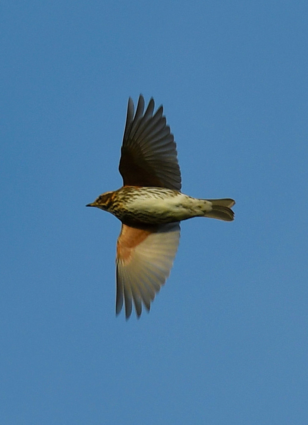
One of the volunteers, Steve Head, has become an amateur wildlife photographer and with permission, has continued to visit the farm he first surveyed – building up a portfolio of fantastic images and helping the farmer continue to record how his conservation actions are impacting farmland birds.
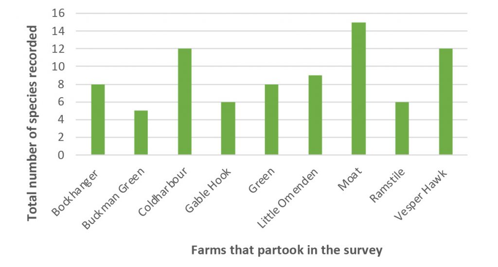
Figure 1 – The total number of species recorded at each farm.

Table 1 – List of species recorded at each farm that partook in the Winter Farmland Wildlife Survey.
Nature’s Sure Connected is funded by a grant from the Heritage Lottery Fund and we thank them for their continued support of the project. We give huge thanks to the volunteers who took part in the survey and the landowners for their permission to access and survey on their land. We are very thankful to Rory, the Upper Beult Farmer Cluster and Southern Water who through a partnerships agreement have been central in developing the approach environment of the River Beult.